Desktop GIS · Windows first

SqsMap Desktop

Open spatial files on your computer, edit features and attributes, check boundaries, run analysis and prepare maps. Supports common vector, imagery, elevation and 3D data. Windows is the current priority.

User manual
SqsMapMap browsing, spatial data processing and map layouts for everyday GIS and forestry work.
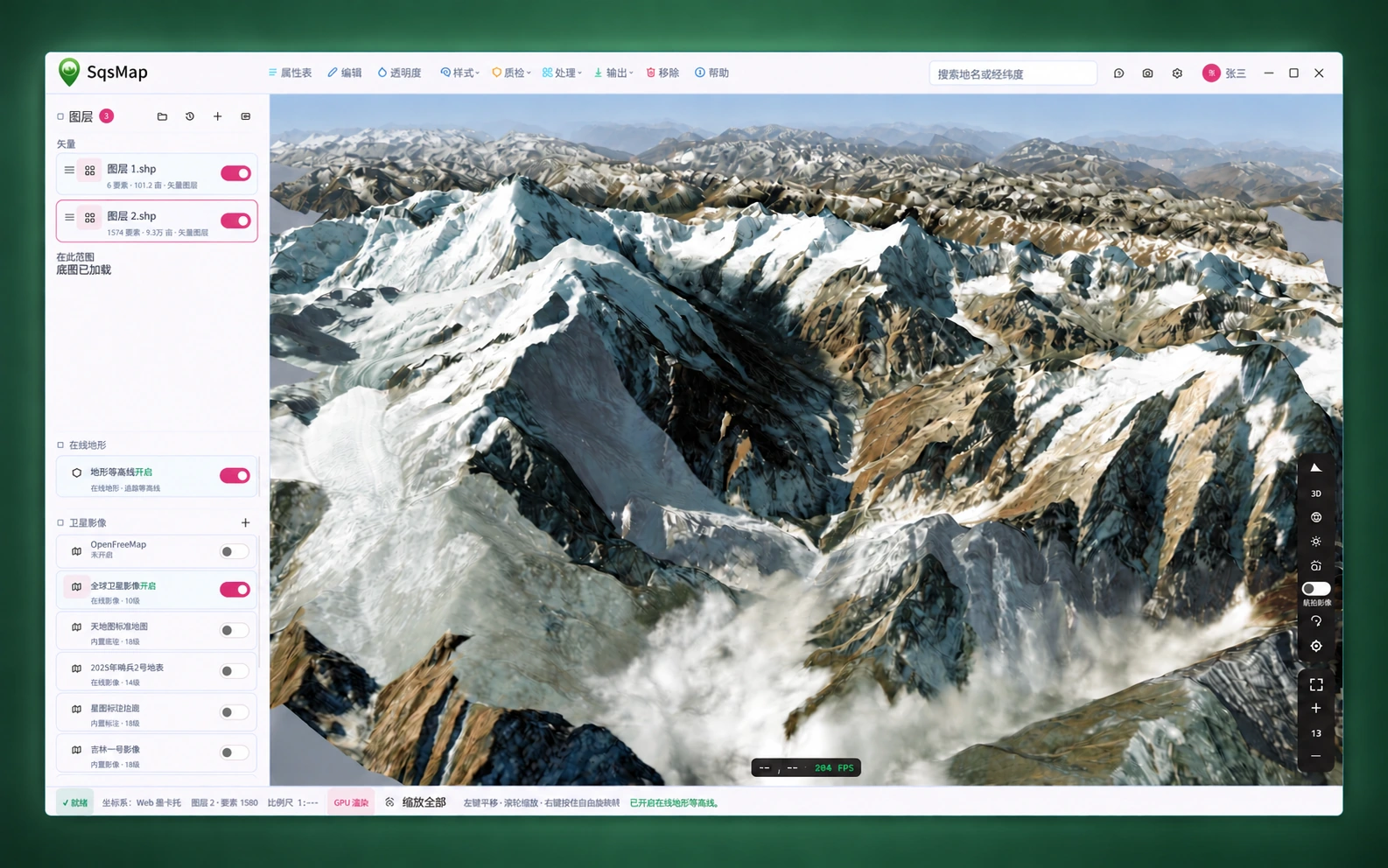
Artistically processed SqsMap client screenshot with the toolbar, layer panel, snowy terrain, map controls and status bar retained
Client screenshot · Artistic treatment

Check your data first

Supported file formats

These formats are supported by desktop data-opening tools. View vectors, imagery, elevation and 3D data in one workbench, with tools suited to each type.

Vectors and databases

  • Shapefile · .shp
  • GeoJSON · .geojson / .json
  • GeoPackage · .gpkg
  • FileGDB · .gdb
  • KML · .kml
  • GML · .gml
  • DXF · .dxf
  • FlatGeobuf · .fgb
  • SJS · .sjs

Open FileGDB as a .gdb directory. Keep Shapefile attributes, indexes, coordinate information and other companion files together.

Imagery and elevation

  • GeoTIFF · .tif / .tiff
  • ERDAS Imagine · .img

Open georeferenced imagery. Use DEMs for terrain display and elevation analysis, checking the coordinate system and height units when loading.

Offline maps

  • MBTiles · .mbtiles
  • SqsMap · .gispak

MBTiles is supported for offline imagery. A .gispak basemap package is a directory; select the entire directory to open it.

Point clouds

  • LAS · .las
  • LAZ · .laz
  • COPC · .copc.laz

Read LAS, compressed LAZ and COPC data. Display points by original color, elevation, intensity or classification.

Models and reality tiles

  • glTF · .gltf / .glb
  • 3D Tiles · tileset.json

Keep glTF textures and related assets together. Open 3D Tiles from the tileset entry file and preserve the directory structure.

Gaussian splats

  • 3D Gaussian Splatting · .ply

PLY here means a 3D Gaussian asset containing Gaussian parameters, not a general point-cloud PLY. Position and orientation can be set after loading.

This list describes input support, not export support. Coordinate systems, geometry types and companion assets also affect reading. See the output section below for export formats.

Tools for everyday GIS work

Choose tools for data preparation, analysis and 3D viewing. Use scripts for repeated work or the AI assistant for help with operations.
  • Layers and attributes
    Overlay vectors, imagery and basemaps. Adjust layer order and styling, inspect feature attributes, and check positions and coordinate systems.
  • Editing and topology
    Create or edit points, lines and polygons, and update attributes. Find overlaps, gaps and self-intersections, then locate, review and repair them.
  • Spatial analysis
    Build buffers, intersect, erase, dissolve and summarize data. Add results to the map to compare them with the source layers.
  • Terrain and 3D data
    View terrain relief, buildings, models and reality tiles. Load point clouds and Gaussian splats, and check scene position and height.
  • AI-assisted operations
    Describe a query, analysis or mapping task in plain language. The assistant uses existing tools and requests confirmation for changes, deletions and overwrites.
  • Forestry data
    Read stand attributes with forestry code tables. Compare boundaries, imagery and terrain, and prepare survey data, statistics and thematic maps.
  • Scripts and batch work
    Use JavaScript for repeated operations, data queries, map control and output. Check the script reference for supported platforms.
  • Map layouts and output
    Style layers, add a legend, scale bar and north arrow, and export PNG images or PDF maps for reports and archives.
  • Online and offline maps
    Use vector basemaps, imagery and online terrain, or open local offline packages. Prepare maps and data before fieldwork.

A typical data task

From opening files to saving results

For a batch of forest stands or land parcels, a practical sequence is:

  1. Load and locate

    Open the data and overlay imagery or a basemap. Check coordinates, extent and layer order to confirm alignment.

  2. Review attributes and boundaries

    Inspect attributes and find overlaps or gaps. Locate features on the map before editing them.

  3. Analyze and review

    Choose a buffer, overlay or summary operation. Put results on the map and compare them with the original material.

  4. Save data and maps

    Export results in the required format, prepare report maps, and retain the source material for later review.

Save your results

Data, maps and analysis outputs

Input and output support are listed separately so you can plan your deliverables.

Vector data

Shapefile / GeoJSON / GeoPackage / KML / SJS

Save prepared layers as spatial files for further work or delivery. SJS files can optionally be password-protected.

Map output

PNG / PDF

Export a map image or a PDF with layout elements. Save spatial data and report maps separately.

Elevation and point-cloud analysis

GeoTIFF / GeoPackage / CSV

Elevation tools output hillshade, slope, aspect and contours. Point-cloud tools output elevation or density rasters and classification summaries. Formats depend on the task.

Download SqsMap Desktop

Download a desktop package. Windows is the current priority; available platforms, architectures and versions are listed below.
Linux 1.6.0
优化高斯泼溅
x64 · rpm · pc · 70.9 MBDownload
Linux 1.6.0
优化高斯泼溅
x64 · deb · pc · 71.2 MBDownload
Windows 1.5.1
新增地形演示
x64 · msi · pc · 72.0 MBDownload
macOS 1.4.0
算青山GIS助手macos
arm · dmg · pc · 81.4 MBDownload

Use an official complete package to include the runtime files needed for format reading and coordinate conversion. See the desktop manual for instructions.